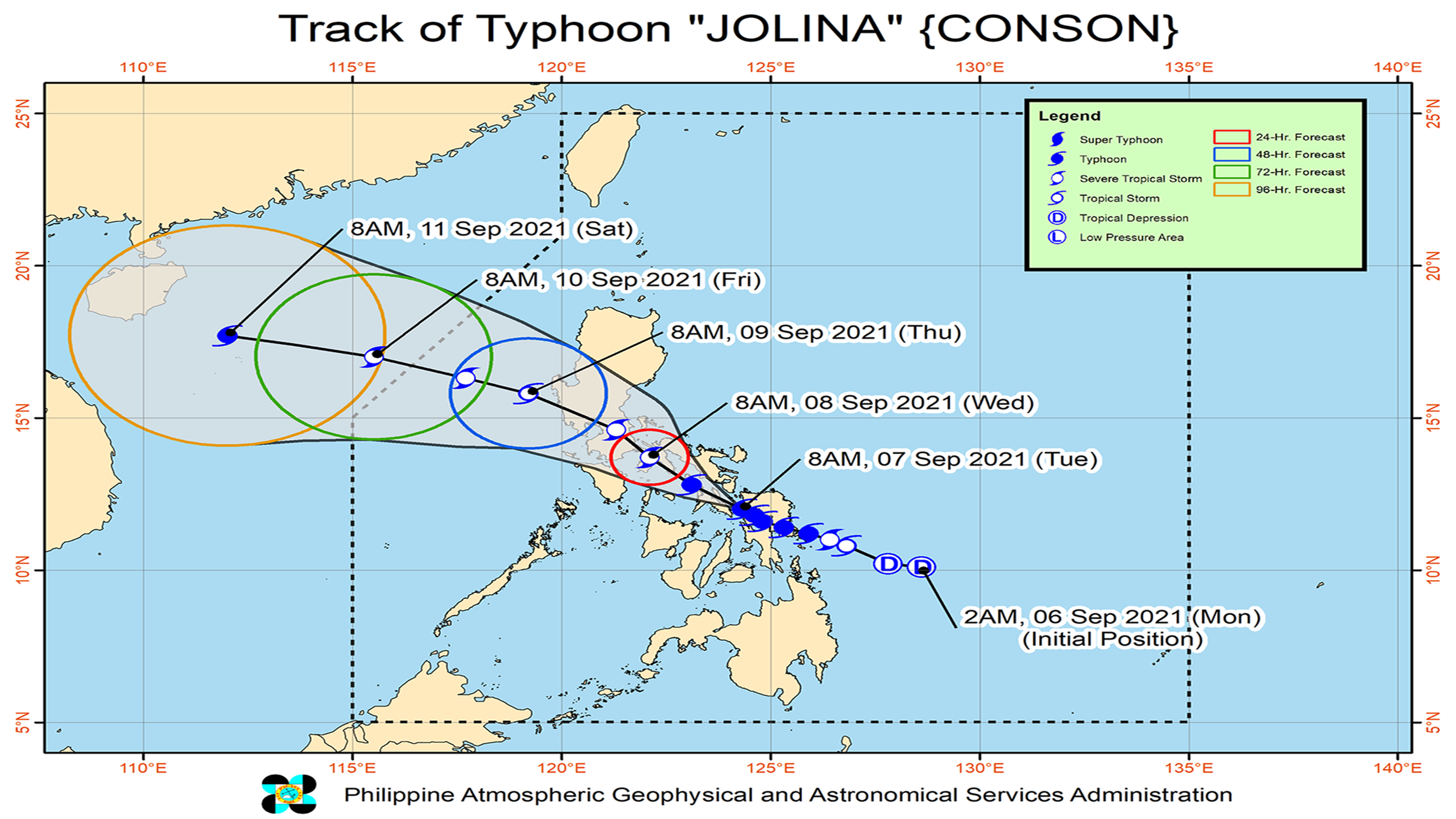
“Jolina” is now expected to to move generally west northwestward traversing Masbate and Ragay Gulf before making another landfall in the vicinity of southeastern Quezon tonight or tomorrow early morning.
TYPHOON “Jolina” has made landfall over Masbate and is now heading towards Quezon province, according to the state weather bureau.
In its latest bulletin, the Philippine Atmospheric, Geophysical and Astronomical Services Administration (Pagasa) sighted the center of “Jolina” in the vicinity of Dimasalang, Masbate.
The typhoon has maintained its maximum sustained winds of 120 kilometers per hour (kph) near the center and gustiness of up to 150 kph, and is moving west northwestward at 15 kph.
Typhoon signal no. 3 is now raised over the extreme southern portion of Quezon, including the towns of San Francisco, San Narciso, San Andres, Mulanay, Buenavista, Catanauan.
Meanwhile, the central and southern portions of Quezon and the southeastern portion of Batangas are now under typhoon signal no. 2.
Typhoon signal no. 1 is also raised over Rizal, Laguna, Cavite, and the rest of Batangas province.
“Jolina” is now expected to move generally west northwestward traversing Masbate and Ragay Gulf before making another landfall in the vicinity of southeastern Quezon tonight or tomorrow early morning.
It will then briefly emerge over Lopez Bay before making landfall in the vicinity of northern Quezon.
“Throughout the remainder of tomorrow and into Thursday morning, the tropical cyclone is forecast to cross Central Luzon (roughly to the east and north of Metro Manila),” when it is expected to weaken into a tropical storm, Pagasa said.
Tags: #typhoon, #weather, #Pagasa, #JolinaPH

